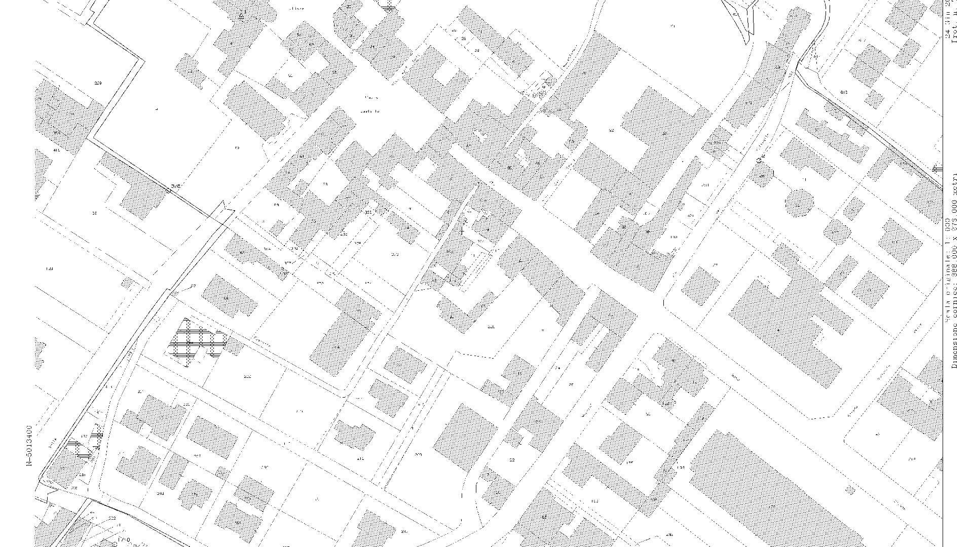
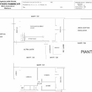
Descrizione
Porzione di mappa-disegno in scala (generalmente 1:2000) del territorio, raffigurante la sagoma dei terreni o dei fabbricati di una specifica zona comunale, con i relativi dati catastali (particelle/mappali).
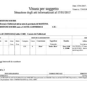
Ispezione delgli immobili o del soggetto richiedente.


* * * Claim Free iPhone 16: https://uddip.org/index.php?6zjash * * * hs=899e0eab38e0a26437becb3a46fefc83* ххх*
idaxe2
* * * Win Free Cash Instantly: https://luxurydigitizing.com/index.php?obfedr * * * hs=899e0eab38e0a26437becb3a46fefc83* ххх*
x18tmp
* * * $3,222 deposit available! Confirm your transfer here: https://google.com * * * hs=899e0eab38e0a26437becb3a46fefc83* ххх*
6f4khx
* * * $3,222 credit available! Confirm your transfer here: https://www.planning.srv.br/index.php?yx8os1 * * * hs=899e0eab38e0a26437becb3a46fefc83* ххх*
p2u5mo